
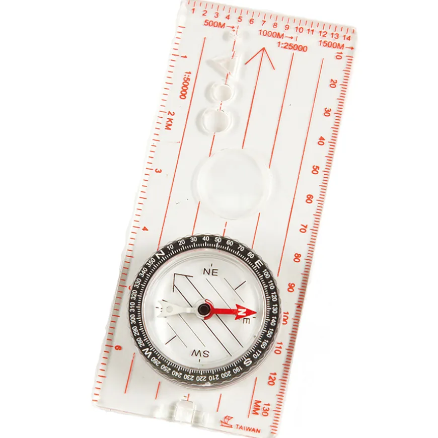
Map Compass
£8.35
Helping to Support Teaching and Learning
-
Enhances outdoor learning
-
It is an essential tool to learn how to navigate using maps and natural landmarks.
-
Educational Enhancement
-
This compass is an invaluable aid for teaching advanced mapping techniques, thanks to its benefits including a magnifier and cm/mm rulings on each side.
-
Supports Curriculum
-
Enhances lessons on geographical skills and fieldwork through practical application, directly supporting the Geography curriculum at Key Stage 2.
-
Facilitates Learning
-
Encourages observation, measurement, and presentation skills through hands-on learning and engagement with physical and human geography.
-
Geographical Skills
-
Aligning with Key Stage 2 aims, the product enhances the educational process by being ideal for exercises in using maps, atlases, globes, and digital mapping to locate countries and describe features.
Map Compass
A high-quality compass designed with a transparent baseplate and ruler edge to make measuring of distances on maps easy.
Overview
-
Enhances advanced mapping skills with a built-in magnifier and cm/mm measurements on each side, ideal for educational use.
-
Constructed from transparent plastic, this Map Compass incorporates a magnifier and cm/mm measurements on each side, making it perfect for teaching geographical skills in line with the Key Stage 2 curriculum. It aids students in using maps, atlases, and digital resources effectively, providing a hands-on approach to learning about the world.
-
This map compass is useful for fieldwork, allowing children to observe, measure, and present features of their local area through various methods. Its clear base enhances map readability, facilitating both classroom activities and outdoor exploration. Emphasising practical learning, the compass helps develop teamwork, problem-solving, and detailed observation skills.
-
Acting as a bridge between theoretical knowledge and practical application, the compass supports a range of learning outcomes. From understanding human and physical geography to refining map-reading skills, it ensures an engaging educational experience.
Supports the National Curriculum
Geography, Key Stage 2, Geographical Skills & Fieldwork
Use maps, atlases, globes and digital/computer mapping to locate countries and describe features studied.
Geography, Key Stage 2, Geographical Skills & Fieldwork
Use fieldwork to observe, measure record and present the human and physical features in the local area using a range of methods, including sketch maps, plans and graphs, and digital technologies.
Product Information
| Pack Size | 1, 15 |
|---|
Be the first to review “Map Compass”
Related products
Art & Craft
Art, Craft & Design
Exercise Books
Art & Craft
Art, Craft & Design
Art, Craft & Design
Art & Craft
Art, Craft & Design
Art, Craft & Design
Art, Craft & Design
Art, Craft & Design
Art, Craft & Design
Art & Craft
Art, Craft & Design
Reviews
There are no reviews yet.