
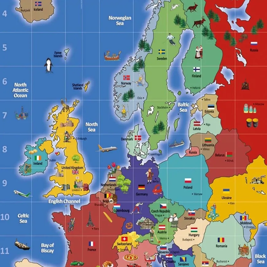
TTS Bee-Bot® European Map
Original price was: £55.48.£39.44Current price is: £39.44.
Helping to Support Teaching and Learning
-
Versatile Display Options
-
You can use this map on the floor for interactive learning with Bee-Bot or mount it on the wall to enhance its visibility and accessibility in educational settings.
-
Vibrant Geographical Learning
-
Designed to vividly showcase physical geography, this map aids in teaching about countries, capitals, seas, and oceans, making it a visually engaging resource.
-
Enhanced Discussion
-
This map includes imagery designed to stimulate discussion about the human characteristics of each country identified, directly supporting geographical education.
-
Durable Educational Tool
-
Constructed from scratch-resistant vinyl, ensuring longevity and continued use in busy educational environments without fading.
-
Supports Key Stage Learning
-
Aligns with Key Stage 1 and 2 curriculum, focusing on geographical skills and locational knowledge, making it an integral part of the learning process.
TTS Bee-Bot® European Map
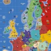
A vibrant educational map featuring key geographical locations with a grid for coordinate work.
Overview
-
Ideal for geography, maths, and ICT lessons, this map is printed on durable vinyl and includes eyelets for easy display.
-
This map enhances geography lessons by providing a durable, non-fading, scratch-resistant vinyl platform for both floor and wall usage. Ideal for active classroom environments, its design includes eyelets for easy display, ensuring educational content is accessible and highly visible.
-
This educational tool not only highlights countries, capitals, seas, and oceans but also fosters essential geographical skills and fieldwork as per the Key Stage 2 curriculum. The map’s clear, focused imagery helps children in using various geographical tools effectively, void of extraneous details that could distract from learning.
-
Geared towards Key Stage 1 and 2 students, this map supports locational knowledge development by identifying key global regions. Additionally, its alpha/numerical grid effectively integrates coordinate work into geography lessons, complementing study areas in maths and ICT, making the map a multifunctional educational resource.
Supports the National Curriculum
Geography, Key Stage 2, Geographical Skills & Fieldwork
Use maps, atlases, globes and digital/computer mapping to locate countries and describe features studied.
Geography, Key Stage 2, Place Knowledge
Understand geographical similarities and differences through the study of human and physical geography of a region of the United Kingdom, a region in a European country and North or South America.
Geography, Key Stage 1, Geographical Skills & Fieldwork
Use world maps, atlases and globes to identify the United Kingdom and its countries, as well as the countries, continents and oceans studied at this key stage.
Product Information
Overview
-
Suitable for age 5 years and up
-
Vinyl
Age Range
Material
Sizes and Measurements
-
145 cm
-
80 cm
-
W80 x L145cm
Length
Width
Dimensions
Be the first to review “TTS Bee-Bot® European Map”
Related products

Art & Craft
Art, Craft & Design

Art, Craft & Design

Art, Craft & Design
Art, Craft & Design
Art, Craft & Design
Art, Craft & Design
Art, Craft & Design

Art, Craft & Design
Art, Craft & Design

Art, Craft & Design

Art & Craft
Art, Craft & Design
Reviews
There are no reviews yet.